16 Largest Peninsulas in the World (By Area)
There are thousands of peninsulas out there. Have you ever wondered which ones are the largest? In this post, I’ll cover the largest peninsulas in the world. They are listed by area – in square miles and kilometers.
What’s the world’s largest peninsula? The Arabian Peninsula is the world’s largest at 1.2 million square miles, but there are many others out there as well. The Deccan / Indian Peninsula is the second largest peninsula in the world.

Without further ado, here are the 16 largest peninsulas in the world!
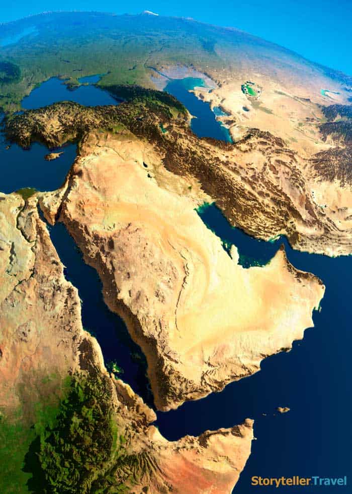
1. Arabian Peninsula
- Area: 1,250,006 square miles / 3,237,500 km²
- Continent: Asia
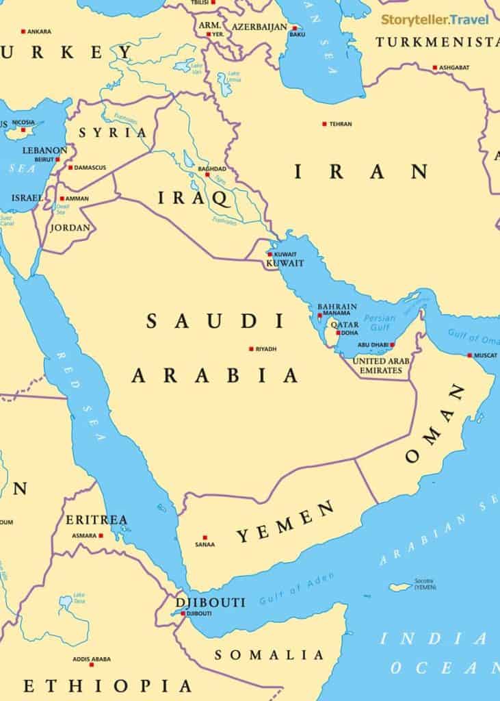
As said above, the Arabian Peninsula is the largest in the entire world at 1,250,006 square miles in size. Its northern side flows into the Arabian desert and is considered to be the unofficial border between Kuwait and Saudi Arabia.
The Arabian Peninsula contains a vast variety of landscapes ranging from deserts and mountain ranges (namely the Hejaz mountain range) to marshy coastal lands. While it is unsuitable for agriculture, goat and camel herding is a common practice on this peninsula.
The Arabian peninsula is home to the Arabian Desert, one of the world’s largest deserts.
2. Deccan (Indian) Peninsula
- Area: 800,000 square miles / 2,071,990 km²
- Continent: Asia
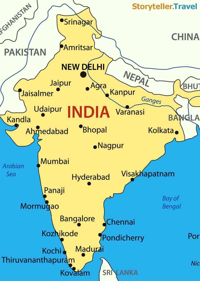
The Deccan/Indian Peninsula comes in second place at 800,00 square miles in size. Located in south-central India, this peninsula contains the Eastern and Western Ghats mountain ranges.
Unlike the Arabian Peninsula, Deccan is richly covered with forests and biodiversity.
It serves as a refuge for many threatened species including elephants, crested-serpent eagles, and tigers. The climate is somewhere between semi-arid and tropical and includes agriculture such as sugarcane, rice, and cotton.
Learn more about India in our travelers guide.
3. Indochina
- Area: 748,553 square miles / 1,938,743 km²
- Continent: Asia
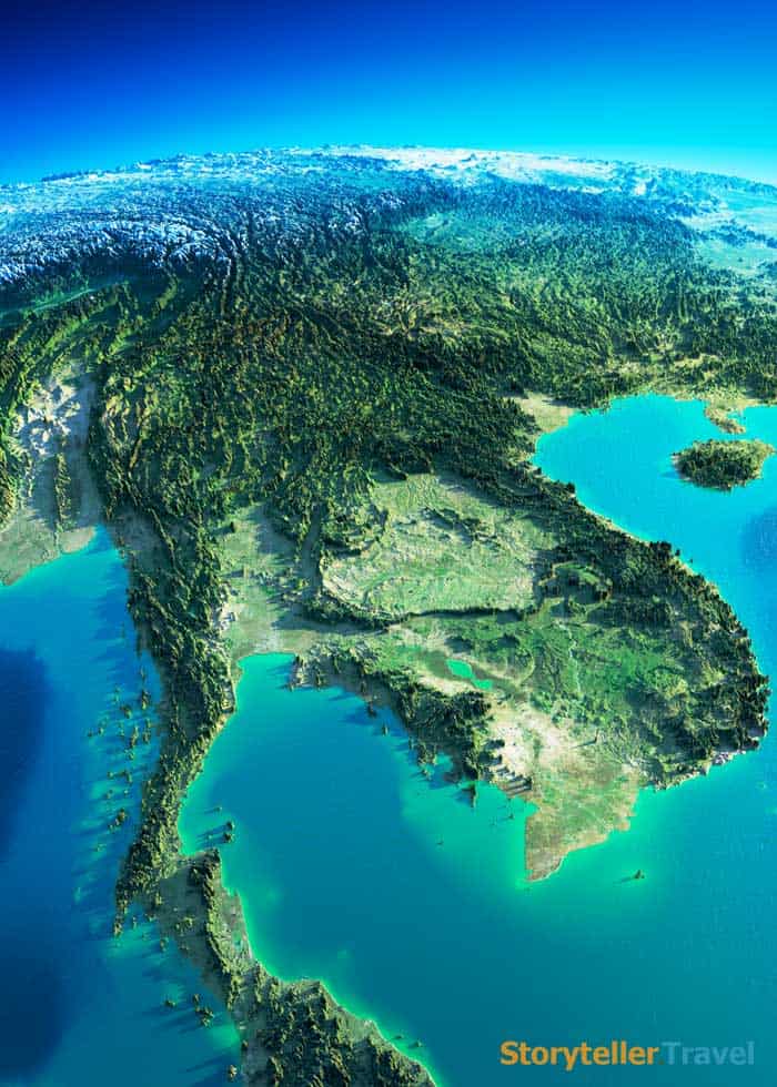
The third-largest peninsula in the world, the Indochina Peninsula, encompasses about 748,553 square miles. Indochina is what is considered to be Southeast Asia.
There are five countries located here, including Laos, Vietnam, Cambodia, Thailand, and Myanmar.
Boasting three waterways, six highways, two railroads, and two oil and gas pipelines, Indochina is quite possibly one of the most important trade routes in the region.
The Indochina Peninsula is also home to over 1,000 species of bird and 300 species of mammals.
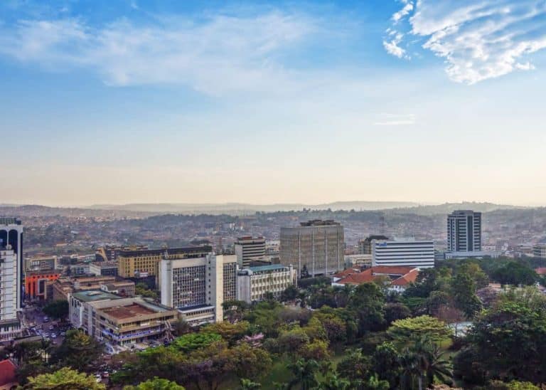
4. The Horn of Africa
- Area: 726,975 square miles / 1,882,856 km²
- Continent: Africa
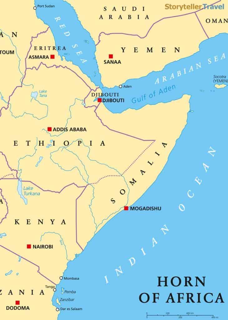
The Horn of Africa is located in northeastern Africa and is about 726,975 square miles in size. It is surrounded by the Arabian Sea.
The area contains the nations of Djibouti, Eritrea, Somalia, and Ethiopia, and the combined population comes close to 115 million people.
This peninsula boasts a wide range of plant and animal species, including leopards, antelopes, and over 285 species of endemic reptiles. It is covered by both mountain ranges and desert areas, and it has key exports of coffee, livestock, and bananas.
5. Alaskan Peninsula
- Area: 579,153 square miles / 1,500,000 km²
- Continent: North America
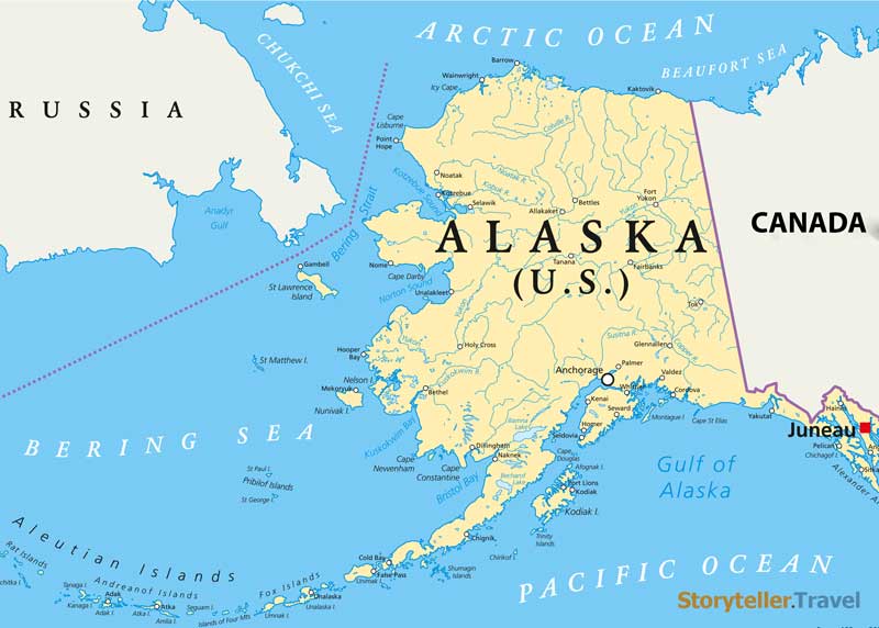
The Alaskan Peninsula comes in fifth place at 579,153 square miles. This peninsula serves as the barrier between the Pacific Ocean and Bristol Bay (which is actually a part of the Bering Sea).
The Aleutian volcanic range runs along the entire length of the peninsula, and the Pavlof Volcano sits near the southeastern edge. It rises to over 8,260 feet in height and is considered to be the most active volcano in the Aleutian arc.
The Alaskan Peninsula also contains the McNeil River State game sanctuary, which is home to a fairly large population of brown bears.
6. Labrador Peninsula
- Area: 540,543 square miles / 1,400,000 km²
- Continent: North America
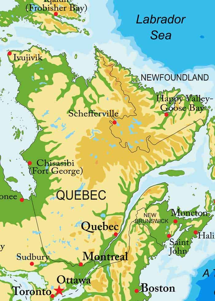
The Labrador Peninsula is about 540,543 square miles in size and is located in eastern Canada. The sixth-largest peninsula in the world, it is bordered by water on all sides except the southwest side, where it widens and becomes the continental mainland.
It is bordered by the Gulf of Saint Lawrence to the south, the Labrador Sea to the east, the Hudson Strait to the north, and the Hudson Bay to the west.
It is shared by two Canadian provinces: Quebec and Newfoundland and Labrador. Regions in Quebec include the regions of Cote-Nord, Nord-du-Quebec, and the Saguenay-Lac-Saint-Jean. The peninsula includes the region of Labrador, from the province of Newfoundland and Labrador.
7. Anatolian Peninsula
- Area: 292,000 sq mil / 755,688 km²
- Continent: Asia
Anatolia is the westernmost part of the Asian continent. To the north is the Black Sea and to the south is the Mediterranean Sea. To the west is the Aegean Sea, and the Turkish Straits to the northwest.
It is also known as the Anatolian plateau, Asia Minor, and simply Anatolia.
The largest city in Anatolia is Ankara, with a population of 5,700,000. The entire peninsula is inside of the country of Turkey. And it forms the major part of Turkey.
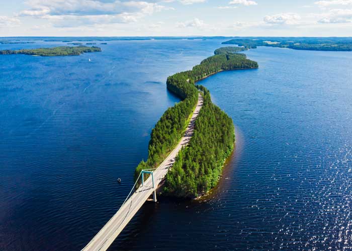
8. Scandinavian Peninsula
- Area: 289,577 square miles / 750,000 km²
- Continent: Europe
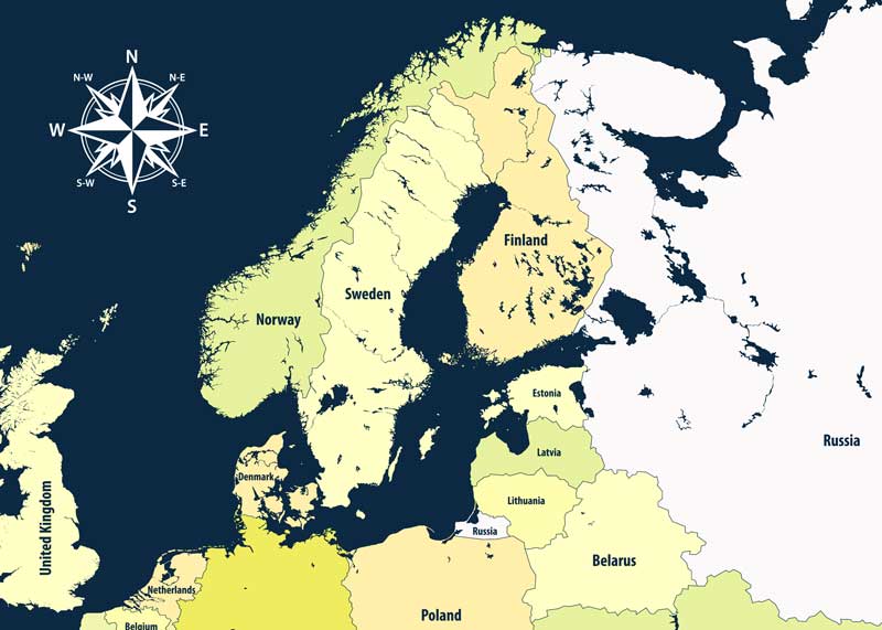
The Scandinavian Peninsula is the seventh-largest peninsula in the world, and the largest peninsula in Europe, at 289,577 miles.
It comprises a tiny bit of Northwest Russia, the northwestern area of Finland, and the mainlands of Sweden and Norway.
It is bordered by the Barents Sea to the north, Denmark to the south, Russia, the Gulf of Bothnia, the Baltic Sea to the east, and the Norwegian Sea to the west.
9. The Balkan Peninsula
- Area: 257,414 square miles / 666,700 km²
- Continent: Europe
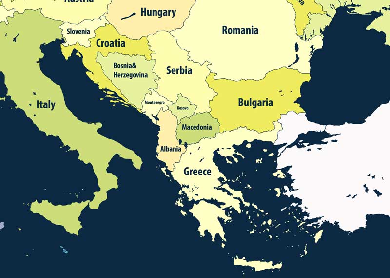
The Balkans (often called the Balkan Peninsula) is about 257,414 square miles in size. It is the easternmost of Europe’s three southern peninsulas.
While there is no universal agreement on its exact components, the Balkans are often said to comprise parts of Greece, Bosnia, Albania, Herzegovina, Croatia, Bulgaria, Montenegro, Romania, Serbia, North Macedonia, Slovenia, and Kosovo.
10. Iberian Peninsula
- Area: 224,711 square miles / 582,000 km²
- Continent: Europe
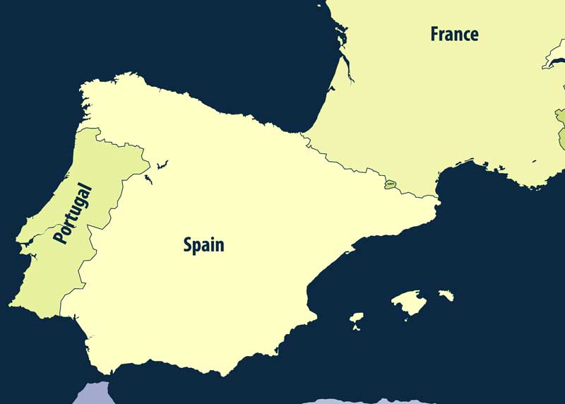
The Iberian Peninsula is another of Europe’s largest at 224,711 square miles and is located on Europe’s southwestern tip.
There are 5 countries and regions on the Iberian Peninsula: Spain, Portugal, France, Gibraltar, Andorra.
The Iberian peninsula is the westernmost peninsula in Europe. Its southern tip is separated from the African continent by the narrow Strait of Gibraltar and is only eight miles (13 kilometers) from Africa at its narrowest point.
11. Kamchatka Peninsula
- Area: 104,248 sq mi / 270,000 km²
- Continent: Asia
The Kamchatka Peninsula is located in northeastern Russia, on the Pacific Ocean. To the east of the peninsula, you’ll find the Kuril–Kamchatka Trench that lies 34,449 feet deep (10,500 meters).
Is Kamchatka like Alaska? Yes, in many respects. Like Alaska, Kamchatka is also on the “Ring of Fire”. Visitors can tour numerous active volcanoes. It is home to 300 volcanoes, around 25 are still active. It is also on the Pacific ocean and is famous for hiking, fishing, and acid lakes.
The Kamchatka also has rivers full of spawning salmon, geysers, and giant crabs. It also has the Russian version of Alaska’s Iditarod race.
12. Korean Peninsula
- Area: 85,270 square miles / 220,848 km²
- Continent: Asia
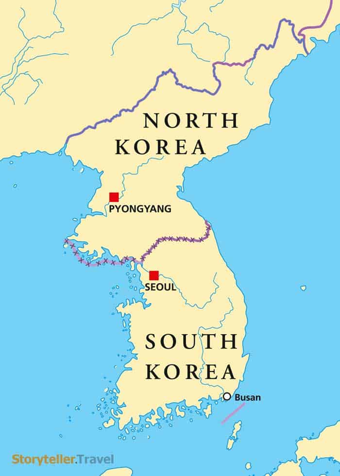
The Korean Peninsula is about 85,270 miles in size. Located in East Asia, this peninsula extends southward for roughly 684 miles from continental Asia and into the Pacific Ocean.
It is bordered by the Korea Strait, the East China Sea, and the Yellow Sea. It has been split in half, with the northern side being occupied by North Korea and the southern side being occupied by South Korea.
13. Florida
- Area: 65,755 square miles / 170,305 km²
- Continent: North America
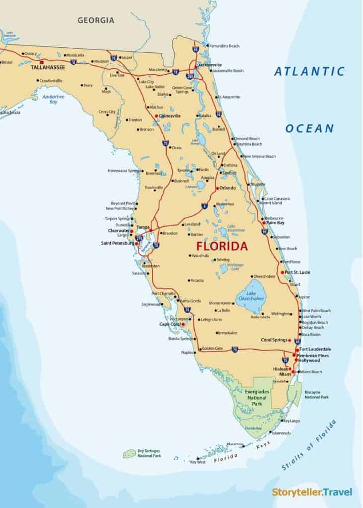
The state of Florida encompasses about 65,755 square miles. Because it is surrounded by the Gulf of Mexico, the Straits of Florida, and the Atlantic Ocean, it is considered to be a peninsula.
This peninsula has over 1,200 miles of coastline and shares borders with the states of Georgia and Alabama.
14. Baja California
- Area: 55,363 square miles / 143,389 km²
- Continent: North America
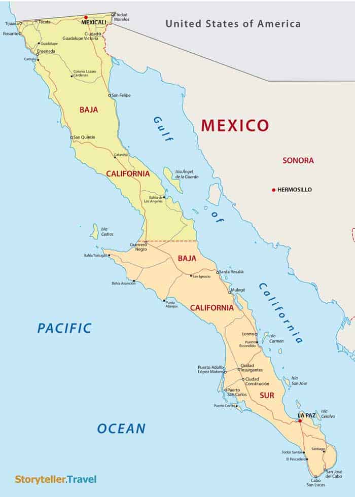
Baja California (which is a state of Mexico) is about 55,363 miles in size. It is bordered by the United States, the State of Sonora, the Gulf of California, the Baja California Sur, and the Pacific Ocean.
A good portion of this state is occupied by an extension of the Sonoran desert and granitic mountain ranges (the Sierra San Pedro Mártir and the Sierra de Juarez).
15. Italian Peninsula
- Area: 50,709 square miles / 131,335 km²
- Continent: Europe
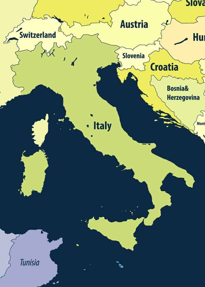
The Italian Peninsula is the four largest peninsula in Europe (after the Scandinavian, Iberian, and Balkan Peninsulas). It has a size of about 50,709 miles and lies to the south.
There is one country (Italy) and two microstates (San Marino and Vatican City) on the Italian Peninsula.
It is surrounded by the Adriatic Sea, the Ionian Sea, the West Ligurian Sea, and the West Tyrrhenian Sea.
It is also the home to a volcanic mountain chain called the Apennines. This area is subject to frequent earthquakes and extends the entire length of the peninsula.
16. Lower Peninsula of Michigan
- Area: 40,162 square miles / 104,019 km²
- Continent: North America
The Lower Peninsula of Michigan has an extent of 40,162 miles and reaches northward from Indiana and Ohio. It is surrounded by the Straits of Mackinac, Lake Michigan, and Lake Huron.
The St. Clair River, Lake St. Clair, the Detroit River, and Lake Erie are all bodies of water that separate this peninsula from Ontario, Canada. The Lower Peninsula has several areas that have been designated by the American Bird Conservancy as Important Bird Areas.
More reading: 14 Largest Lakes in Europe
What is the Plural of Peninsula?
In English, the plural of peninsula is peninsulas. They can also be called peninsulae, although this is less common.
Your Turn
Which of the world’s largest peninsulas stand out most to you? Have you been to some of these? Join me in the comments!


What about the Anatolian Peninsula and the Kamchatka Peninsula? They are clearly larger than some of listed peninsulas in your article.
Thanks for catching that Jim – the post has been updated with both of your recommendations. Thanks!
@Bryan Haines, I see you forgot also about the Yucatan Peninsula. It is about 76000 square km.