Guide to 18 Largest Cities in Uganda (Attractions, Population)
Planning a trip to the country of Uganda? In this post, you’ll learn about 18 of the largest cities in Uganda. You’ll learn information like their population, locations, attractions, and more.
Armed with this information, you should be able to have a more informed trip to Uganda, and hopefully a more enjoyable one.

Guide to Cities in Uganda
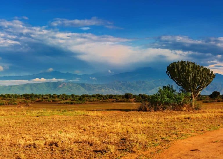
Uganda is a beautiful landlocked country in East Africa. The following list is a brief overview of Uganda’s largest countries, organized in descending order by population size. These figures are recent as of a 2014 national census.
| City | District | Population |
|---|---|---|
| 1. Kampala | Kampala | 1,507,080 |
| 2. Nansana | Wakiso | 365,124 |
| 3. Kira Town | Wakiso | 317,157 |
| 4. Ssabagabo | Wakiso | 283,272 |
| 5. Mbarara | Mbarara | 195,531 |
| 6. Mukono Town | Mukono | 162,710 |
| 7. Njeru | Buikwe | 159,549 |
| 8. Gulu | Gulu | 150,306 |
| 9. Lugazi | Buikwe | 114,524 |
| 10. Mubende | Mubende | 103,473 |
| 11. Masaka | Masaka | 103,227 |
| 12. Kasese | Kasese | 101,065 |
| 13. Hoima | Hoima | 100,099 |
| 14. Lira | Lira | 99,392 |
| 15. Mityana | Mityana | 95,428 |
| 16. Masindi | Masindi | 94,438 |
| 17. Mbale | Mbale | 92,857 |
| 18. Jinja | Jinja | 76,188 |
These cities are spread out through the country’s 4 main regions and many districts. The 4 regions are Central or Buganda, Western, Eastern, and Northern.
Interesting side note on the districts: Uganda has added many over time. Back in 2006, there were 7 districts. By 2010, that number had grown to 111. As of 2020, the number of districts has grown again to 135.
Having looked at a quick overview of the biggest cities in Uganda, let’s take a closer look at the 8 of the biggest.
Note: The top four, while distinct municipalities are considered part of the Greater Kampala Metropolitan Area, or GKMA.
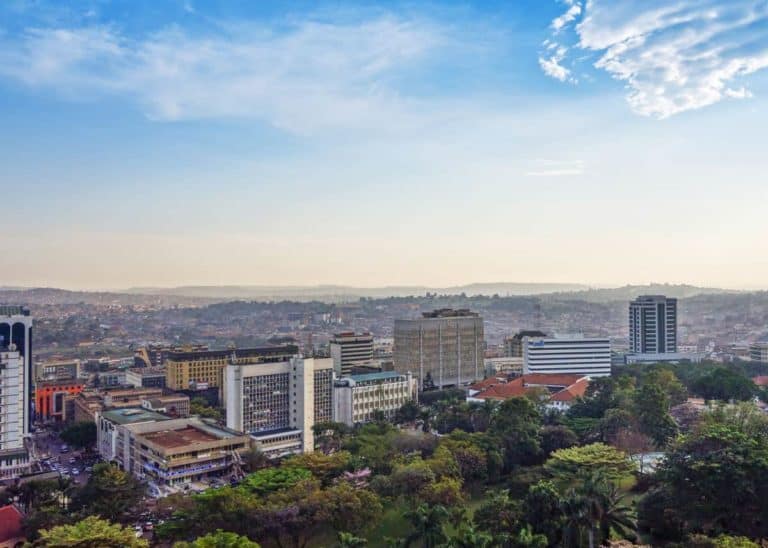
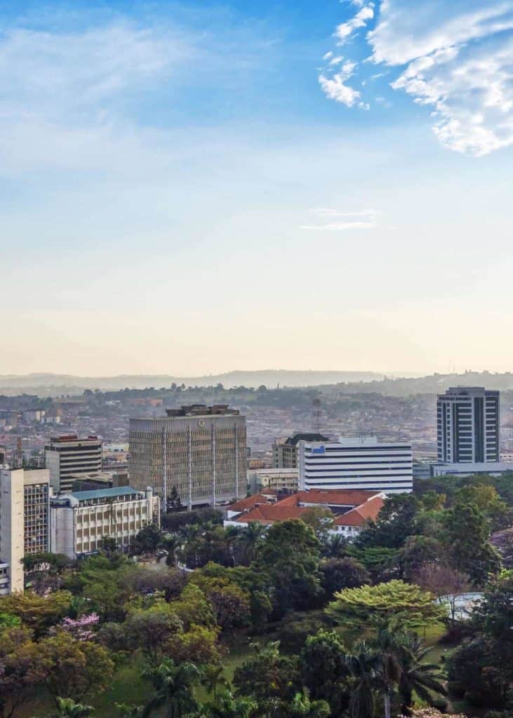
1. Kampala (City proper)
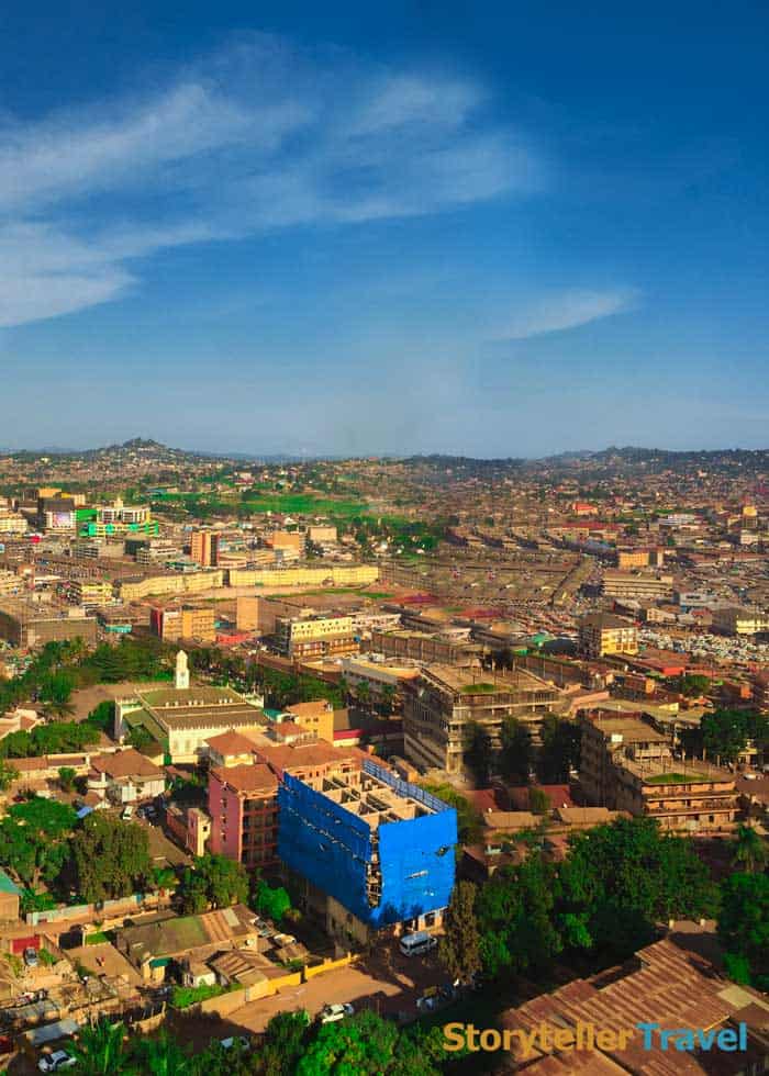
Kampala is the capital city of Uganda. It’s named for the area’s population of impalas.
It’s also the largest by a considerable margin, the only one with a population of 7 figures and has over 1 million more people than the next biggest city.
Kampala is the main economic center of Uganda and thus has a diverse ethnic population. Not only is it the capital of the entire country, but Kampala is also the capital of the Central or Buganda region.
Here are some more details on the city:
- Population: 1,507,080
- District: Kampala
- Region: Central or Buganda
- Demonym(s): Munakampala
- Elevation: 3,900 feet (1,189 m)
- Land area: 68 sq mi (176 sq km) (73 sq mi total for the city including water)
- Time zone: UTC+3 (EAT)
- Climate: Tropical rainforest
- Weather: 2 yearly wet seasons, heavier rain August to December, heaviest rain February to June, average temperature of 77 to 84 degrees Fahrenheit (25 to 29 degrees Celsius)
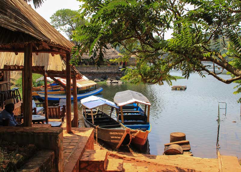
- Kampala Attractions: Owino Market, Rubaga Cathedral, the 7 Hills of Kampala, Kasubi Royal Tombs,
Kampala gained municipal status in 1949, though the area is a core part of the Buganda Kingdom which was unified in 1300.
A few miles south of Kampala, you’ll find Entebbe International Airport. Learn about the airports in Uganda.
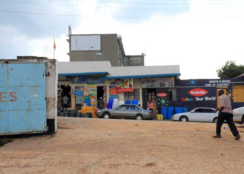
2. Nansana
Nansana is considered to be a working-class neighborhood. It’s found in the Wakiso district, about 7 miles northwest of the capital Kampala, and around 5 miles south of the district capital of Wakiso Town.
Nansana became a Town Council in 2007. The name “Nansana” came from a female ghost “Nansaana” that the Queen mother worshipped around the year 1300.
Here’s a further look into the city of Nansana:
- Population: 365,124
- District: Wakiso
- Region: Central or Buganda
- Elevation: 3,907 feet (1,191 m)
- Land area: 2.8 sq mi (7.2 sq km)
- Time zone: UTC+3 (EAT)
- Climate: Tropical climate
- Weather: Hot and humid, 2 wet seasons (August to December, February to June)
- Attractions: Nexus Resorts Hotel, 4×4 Uganda, Nansana United Football Club
Learn more about weather in Uganda: Uganda Climate Guide
3. Kira Town
Kira Town is part of the Wakiso district and lies northeast of Kampala city proper.
Kira Town became a Municipal Council in July 2015. It is also the location of the biggest stadium in Uganda, Mandela National Stadium.
Here are some more details on Kira Town:
- Population: 317,157
- District: Wakiso
- Region: Central or Buganda
- Elevation: 3,900 feet (1,189 m)
- Land area: 38.16 sq mi (98.83 sq km)
- Time zone: UTC+3 (EAT)
- Climate: Tropical
- Weather: Hot and Humid; 2 wet seasons (August to December, February to June)
- Attractions: Basilica of the Uganda Martyrs, Mandela National Stadium
4. Ssabagabo
Another town part of the Metropolitan area, Ssabagabo (also known as Makindye-Ssabagabo or Ssabagabo-Makindye) became a city in July 2015.
Here are some more details on Ssabagabo:
- Population: 283,272
- District: Wakiso
- Region: Central or Buganda
- Elevation: 3,870 feet (1,180 m)
- Time zone: UTC+3 (EAT)
- Climate: Tropical
- Weather: 2 wet seasons (August to December, February to June)
5. Mbarara
Mbarara is a city in the Western region of Uganda and serves as the capital of that region. It is about 168 miles from Kampala. Founded in 1901, it gained city status as of July 1, 2020.
Mbarara has 2 main sections, Mbarara City North and Mbarara City South, which are further split into 23 wards. The city is also split up into 6 boroughs.
If you take into account that cities 2-4 on this list are part of the Greater Kampala Metropolitan Area, then Mbarara is considered Uganda’s second city.
Here’s a quick overview of Mbarara:
- Population: 195,531
- District: Mbarara
- Region: Western
- Elevation: 4,860 feet (1,481 m)
- Land area: 31.33 sq mi (81.15 km 2)*
- Time zone: UTC+3 (EAT)
- Climate: Tropical
- Weather: Warm and overcast, with temperatures ranging from 58 to 82 degrees Fahrenheit (14 to 28 degrees Celsius)
- Attractions: Mbarara River Rwizi Falls, Nkokonjeru, Mbarara City Football Club
6. Mukono Town
Mukono lies about 13 miles (13 km) east of Kampala, also on the north shore of Lake Victoria.
Mukono gained municipal status in 2010. It is one of the fastest-growing urban areas in Uganda.
In 1991, there were 7,406 inhabitants in the area. That number ballooned to 91,568 by 2002 and continued to grow to 162,710 by the time of the 2014 census.
Here’s a list of some details on Mukono:
- Population: 162,710
- District: Mukono
- Region: Central or Buganda
- Elevation: 4,088 feet (1,246 m)
- Land area: 12.1 sq mi (31.4 sq km)
- Time zone: UTC+3 (EAT)
- Climate: Tropical
- Weather: Muggy, warm, overcast. Temperatures range from 62 to 82 degrees Fahrenheit (17 to 28 degrees Celsius)
- Attractions: Mukono Central Market, Uganda Christian University, Mukono United Football Club
Hungry? Check out our Guide to Ugandan Food
7. Njeru
Njeru is a city that is on the bank of the River Nile, located 46 miles (71 km) east of Kampala, and around 24 miles (38 km) northeast of the district capital of Buikwe. It gained a municipal council in July 2015.
While mainly a residential area, Njeru is the biggest city in the Buikwe District. It also has some manufacturers like Nile Breweries and Nyanza Textiles Industries.
Here are some more details on the city of Njeru.
- Population: 159,549
- District: Buikwe
- Region: Central or Buganda
- Elevation: 3,600 feet (1,097 m)
- Land area: 2.74 sq mi (7.1 sq km)*
- Time zone: UTC+3 (EAT)
- Climate: Tropical
- Weather: Lots of rain, even during the so-called dry season, 79.3 inches (2015 mm) of precipitation per year; average temperature of 71 degrees Fahrenheit (22 degrees Celsius)
- Attractions: River Nile, Nile Breweries, Nyanza Textiles
8. Gulu
Gulu is a city in the Northern Region of Uganda. It lies about 207 miles (333km) from Kampala.
Gulu was the site of refugee camps, with many refugees of Sudan, Rwanda, and Congo. There were as many as an estimated 2 million people who lived in these camps at one point. There has, unfortunately, been some unrest in the area where Gulu is located, with the Lord’s Resistance Army (LRA) waging guerilla warfare there.
Here’s a closer look at the city of Gulu:
- Population: 150,306
- District: Gulu
- Region: Northern
- Elevation: 3,600 feet (1,097 m)
- Land area: 25.68 sq mi (66.51 sq km)*
- Time zone: UTC+3 (EAT)
- Climate: Tropical
- Weather: heaviest rain from March to November, August being the rainiest month, average with 59.4 inches (1,507 mm) of precipitation per year; average temperature of 73 degrees Fahrenheit (23 degrees Celsius)
- Attractions: Pece War Memorial Stadium, Gulu United FC, Gulu University
*These marked land area figures have been taken from the distance measurement tool on Google Maps
Is Uganda Safe? Guide to Water, Crime, Disease, and Sun Safety
More Reading: 15 Incredible Things to do In Uganda
Common Questions about Ugandan Cities
What is the capital city of Uganda?
The capital city of Uganda is Kampala, Kampala district. It is located in the Central or Buganda region of the country, on the northern shore of Lake Victoria.
What is the biggest city in Uganda?
The biggest city in Uganda is the capital, Kampala. It had 1,507,080 inhabitants as of the 2014 census.
What is the Greater Kampala Metropolitan Area?
The Greater Kampala Metropolitan Area is an area that covers a land area of over 3,200 sq miles (over 8,400 sq km).
This area covers cities like Kampala, Nansana, Kira Town, and Ssabagabo. It also covers the districts of Wakiso, Mukono, Mpigi, Buikwe, and Luweero.
How many cities does Uganda have?
Uganda has 74 cities and towns with populations of over 20,000. Included in that are 3 refugee camps.
Your Turn!
Which one of these cities would you like to visit? What did we miss? Let us know in the comments below!